Saturday 28 February 2015

Freezing February Critical Mass

Ok, so it wasn't quite as cold as January's ride, but many of us got caught out by the sudden drop in temperature at the end of the day. This week was reading week in some parts of the university, so that probably reduced the numbers somewhat. It was quite a small ride but with lots of regular riders it was well controlled and stayed together despite a fast pace.


The ride took a new route at the start to try and avoid the worst of the roadworks,


going down between the Town Hall and the extension


and out on to Albert Square.


Then down John Dalton Street, Bridge Street


and across the River Irwell into Salford.


The ride only ventured as far as Chapel Street, before turning up Blackfriars Street and back into Manchester.


Then in an attempt to cross the city centre, down the end of Deansgate


and up round the Cathedral, where it all got a bit difficult because of the road closures.


We regrouped at the back of the Football Museum and ended up in high-fives with the skateboarders who loved the sound systems.


Then we negotiated the next obstacle course to get us across the tram lines


and out onto Corporation Street and up the very steep hill on Rochdale Road which nearly finished me off! The ride ended at the Angel Pub on the corner.


With three sound systems in such a small ride, the musical accompaniment must have sounded pretty chaotic.


One rider was very appreciative of my more ambient tunes, and wants to form a chill-out zone on one of the summer rides, and was asking if I knew any clubs in Manchester that played this kind of thing.

This ride was mostly drawn from Banco de Gaia, with several versions of Last Train to Lhasa.

Friday 27 February 2015

Wilmslow Road Cycleway Consultation

Manchester City Council has today posted proposals for the development of the Wilmslow Road Cycleway - Moss Lane East to Dickenson Road, and is carrying out a consultation.

Two events have been arranged for the public to drop in and see the proposals and discuss them with the team on the following dates:

Tue 17 March, 11.00 a.m. - 7.00 p.m
Spicy Hut Restaurant, 35 Wilmslow Road

Fri 20 March, 9.00 a.m. - 12.00 p.m
Rusholme Sure Start Centre, Great Western Street

I will post analysis of the plans when I've had a good look at them, but the preview we saw at last Manchester Cycle Forum was promising.


The consultation closes Friday 27 March.

Sunday 22 February 2015

Castlefield Utilities/Cycle Bridge Scheme

Now as far as I understand it, this bridge is supposed to be the temporary replacement for Princes Bridge, part of NCN route 6, when Network Rail demolish it to build the Ordsall Chord rail link.

It is also a replacement bridge to carry the utilities across the River Irwell.

However, since the whole Ordsall Chord Scheme is still awaiting the results of a public inquiry, this bridge may or may not have been necessary...


From the Salford side of the river, it is clear that a lot of money has been spent on this Bridge and the path on this side has been extensively reworked to change the level of the towpath.


In fact the towpath has been split in two to accommodate the ramps, and the new bridge has been finished off to match the road bridge.


The surface itself includes bollards at both ends, presumably to stop some idiot trying to drive a car over the bridge.


The bridge links back to the road bridge on the Manchester side,


and then crosses the pavement and dumps you in the eastbound cycle lane...


Yes, you've got it, there is no legal way of getting onto the bridge from the Manchester direction!


From Water Street you have no chance of getting across.


The only option seems to be the pedestrian crossing,


or crossing Water Street onto the pavement at the entrance to the car park


and cycling along here illegally.


It seems that Network Rail have failed to put in the rest of the two way cycle track needed to get the route round to Water Street, which should have gone across this patch of mud.


This bridge is an expensive failure. It will result in many people being forced to cycle illegally along the pavement. I don't know who got to see these plans before they were signed off, but I do remember them being mentioned in a GMCC meeting, so I am pretty sure I know where some of the blame lies.

Meantime preparations have started to demolish Princes Bridge and Network Rail have chosen to block the cycle route...


"New cycle route and footpath to be created between Bolton and Bury"

I came across this headline on the This is Lancashire web site a few weeks ago and have been trying to put together the few scraps of information I can find on the web. The next piece I found was "Final stage of new Bolton cycle route gets green light"on the Bolton News site, along with "Cyclists to be ‘caged’ in new Bolton route"which has a useful picture giving one of the viaduct locations and "Former Bury - Bolton railway line" on the Bury Council web site.

The route will mostly be on the trackbed of part of the old Liverpool & Bury Railway.

From what I can gather, the route will start from Scholey Street on an industrial estate in Bolton - not ideal because of the heavy lorries using the road. The route will then be off road on the old railway line over St Peter's Way on the Burnden Viaduct then over the Darcy Lever Viaduct over the River Tonge. From there it will go along or alongside Gorses Road and divert off the railway route through New House Farm playing fields and back onto the railway line where it reaches the boundary with Bury.

Soon after the railway route is lost at Boundary Drive and Boundary Street in Bradley Fold, but can be rejoined on an existing path for a short way the other side of Bradley Lane. The path is then planned to run along the railway route to another interruption at Black Lane and then rejoining the route the other side to join up with the existing Daisyfield Greenway (photo below) to reach Bury.


If anyone has any more details about this route, I'm curious to know when it is planned to open.

Some old photos of the route.


Broken Bollards, Temporary Plastic Crap

The top set of plastic bollards on Middlewood Street have now gone, thanks to the efforts of passing drivers, most likely in HGVs.

These Jislon plastic traffic islands with bollards were only installed ten months ago, so they haven't even lasted a year.


The two bollards are still lying in the grass verge amongst the rubbish.


The remaining island is now badly scared and bits of plastic can be found in the cycle lane, evidence of the many drivers who either can't see where they are going or don't care where they drive.


Previously there was one...


Originally there were two...


The councils and TfGM love these plastic islands and armadillos because they are cheap. However, they are quickly damaged by traffic and would become an expensive maintenance burden, if only they cared about cycle route maintenance...


Whalley Range on Wheels Launch

Via a flyer found at Popup Bikes

Launch of Whalley Range on Wheels
Sunday 1st March 11am - 4pm
Alexandra Park, Whalley Range


Thursday 12 February 2015

Oldham Cycle Forum

I received the following email today from marketing@oldham.gov.uk

Dear Cycle Forum Member,

We’re contacting you with an update following the last forum meeting in September 2014.

Following the meeting, we’ve been looking into how we can continue running the forum in the most effective format. We’ve listened to the feedback from the last forum meeting and have been speaking to other Greater Manchester cycle forums and cycling groups to investigate how we can get the most out of any future engagement with both current and potential cyclists.

We’re committed to the future of the forum and recognise the importance of maintaining a productive two-way relationship with cyclists.

We’ll be in contact in the coming weeks with further information.

Many thanks.


Best Regards,


Bethan Blair

Marketing & Communications

Oldham Council

Tel. 0161 770 5233


Seems to me like an utterly pointless email...

Sunday 8 February 2015

Update on Vélocity 2025 Progress

It is often hard to find out what has been going on with the Vélocity 2025 project. Not least because Manchester City Council and TfGM seem to have re-branded it as "Better by Cycle".

However, a report on the Cycle City Ambition Grant to the Manchester City Council Neighbourhoods Scrutiny Committee has been published on the council's web site and gives the latest news on the routes. The meeting will take place at 2pm this Tuesday the 10th of February in the Scrutiny Committee Room on Level 2 in the Town Hall Extension

The report is item 6 on the agenda "Cycle City Ambition Grant - Report of the Deputy Chief Executive"

The purpose of the report is to update members on the progress of the Vélocity 2025 project and the delivery of the first phase of investment that is funded through the Cycle City Ambition Grant (CCAG).
The document is worth reading through to get all the details, and the attitude conveyed. However the headline news is on page 40.

6.8 As with each of the other cycleways, the proposed Prestwich Cycleway was subject to extensive consultation. However, unlike the other cycleways, this route garnered very little support. The principle concerns were that it didn't go where cyclists would want to go and that the proposed leisure route was unlikely to encourage the take up of cycling, which was a key objective of the CCAG. It was therefore felt to represent poor value for money. As a consequence of this consultation, it is now proposed that the Prestwich Cycleway does not proceed as part of the first phase of the CCAP.


So the Prestwich Cycleway project has been dropped, but the others continue with very little modification. Whilst the Prestwich route was a real dogs breakfast, it wasn't the only route with problems and now this leaves the project with no route reaching into the north of the city.

The other news is what's being bid for next. Whilst the next round of money is going to be spread thinner, across the whole of Greater Manchester, Manchester is still looking for its share...

8.7 The allocation being sought by Manchester City Council is to deliver the following work:
  1. City Centre Package - The detail would emerge following consultation with stakeholders
  2. Upper Chorlton Road - There is already an established cycling demand on this route and the width of the road means that there is scope to provide high quality cycling routes
  3. Rochdale Canal Towpath - This would provide a route similar to that already in place along the Ashton Canal.

So what are we to make of the three new proposals?

Well the City Centre is currently a mess, almost impenetrable for cycles, and thanks to TfGM/Metrolink getting far worse. However, I doubt that there will be anything like enough money to put right all the damage, and this follows on from the dreadful LSTF plans.


The Upper Chorlton Road route will tap into the highest concentration of cycling in the city, and this route is currently, often full of parked cars, so it does need a lot of work. One thing to note is that this announcement comes just after a letter in the MEN from the three Chorlton Councillors.


The Rochdale Canal is a bit of a no-brainer. However, like the city centre it will probably take a lot more money to sort out properly. The route is narrow in places and contains several big sets of steps, and in a couple of cases there is no way round for a tricycle or bike with children in a trailer.


So the chosen projects all make sense, but whether there is the money, expertise and political will to see them through is another matter.

Great Bridgewater Street Cycle Lanes

Not really sure what is going on here. This looks like somebody spending the LSTF money because they haven't been able to sort out a safe design for the Deansgate junction.Alternatively I could spin it as a campaigning victory... See part way down this post where I insist on 2m wide cycle lanes but on second thoughts I'd rather not.

On the short (less than 100m) section of Great Bridgewater Street between Deansgate and Watson Street new cycle lanes have appeared over the past couple of weeks.


They could be claimed to be 2m wide, but only if you include the gutter and the thickness of the white line. Unfortunately the north side is only single yellow lines, so this will get blocked by parked cars in the evenings.


On the south side there is also a parking bay on the inside of the cycle lane.


And of course these are only advisory cycle lanes so there is no chance of any driver getting done for driving in them..


All in all one has to wonder why this piece of tokenism has been rolled out now...

Ashton to Oldham Greenway

This route begins about half a mile from Ashton-under-Lyne town centre, just to the north of the site of a short tunnel under Lordsfield Avenue and follows the path of the Oldham, Ashton and Guide Bridge railway most of the way. There are the usual set of barriers to make access difficult for non-standard cycles, but nothing out of the ordinary. I rode this route with Ian Tate who features in many of the photos.


To get to the start of the path go up Turner Lane, past the railway station, fork right to avoid going down Turner Street and the path entrance is at the end of Turner Lane. To get here from the end of the Ashton Canal is a nightmare, and we ended up walking most of the way.


The path has been designated NCN Route 626.


The first notable landmark on the route is the three arched bridge under Cranbourne Road.


The next bridge carries a footpath that connects to Waterloo Road,


which is soon followed by this new structure that takes the path under Wood Lane.


After Wood Lane the character of the path changes. It looks like the cutting has been filled in, and the path goes between two modern housing estates, mostly hidden by the trees.


There is another barrier where the path crosses between Meadowbank and Bristol Avenue.


The path then enters the countryside, where at Alt Hill Lane, the old bridge has been removed. There are the usual barriers


and a notice reminding you that this is not a right of way...


After Alt Lane the path climbs back up to the track bed. Be warned this part of the path is often used by novice horse riders so watch out!


As you approach Park Bridge, just before the location of the old railway station, the path then curves away to the right, taking you off the main trackbed and onto the route of a siding that ran quite steeply down to the ironworks. The main line went over a viaduct at this point, but it was demolished in 1971.

There was a bid to build a replacement bridge at this point as part of Connect2, but it failed to get funding.


Here the path descends and has another set of barriers at Alt Hill Road.

Watch out for the horse shit!

At this point it is quickest to turn right down the road and descend into Park Bridge.


However, you are guided across the road and here the tarmac path gives way to a soft sandy surface.


After looping round 180 degrees you cross this wooden bridge and enter the village past the remains of the ironworks. At this point you can join the Fairbottom Branch Canal and Tramway - Waterhouses Junction to Park Bridge route.


Now you have to climb back up through the village


past the Heritage centre, which was closed


and then turn left up Dingle Terrace.


At the end is the path access through this horrible anti-cycling barrier.


There is then a further steep rough slope to regain the level of the old trackbed.


Initially the path runs somewhat to the east of the old railway line,  but then goes round the edge of this field. This is roughly the location of the local authority boundary between Thameside and Oldham.


and rejoins the trackbed at this right turn.


The path now regains the character of an old railway for a while.


Here there is open land to the east, and Hathershaw to the west


There are the occasional strange markings in the tarmac...


A bit further north there is a lot of new housing and other development going on and it looks like this has been used as an access route.


The path then swings to the right, leaving the track bed where there are football pitches on the right hand side.


Here there is another barrier as the path now turns into Kings Road.


Here Honeywell Lane turns left and becomes Kings Road.


The path now can be seen to the left, where it gets back on to the old railway trackbed.


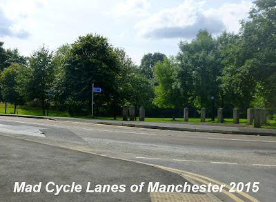
Here the path is part of a linear park that runs alongside the road.


This sign marks the path across to Alexandra Park and the Wheels for All project.


The path then sweeps gently to the right


before ending, somewhat abruptly at Park Road in Oldham.


Here the sign gives no clue as to where the path goes next.


On the opposite side of the road is a huge Matalan outlet.


The car park is roughly the site of the old Clegg Street Station, but there is no sign of it now.


This is more or less the end of the Oldham, Ashton and Guide Bridge railway, and the next section of line will be the subject of a separate post.


Map showing the whole of the Oldham, Ashton and Guide Bridge Junction Railway (in yellow) and connecting lines.