Monday 31 August 2015

Delph Donkey Line - Delph to Undermill

The Delph Donkey path is on the old trackbed of the London and North Western Railway (LNWR) branch linking Delph with the Huddersfield line, which is still in use today.

Starting out from Delph New Road, just down from the junction with Oldham Road the site of the old station is marked by this sign.


The path goes into a small housing estate on Station Approach.


As Station Approach turns to the left the route of the railway goes onto waste ground.


Here a developer blocked the route back in 2008, but nothing came of it and the fences have been broken down, though the access is over a steep bump.


The path covers the waste ground that was to be the development,


and exits through another broken down fence. Here the steps on the left go down to the road.


Now the path gains a good surface and is reasonably well maintained.


After the first bridge


is the site of Measurements Station marked by another board.


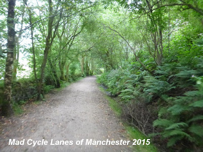
Now the path surface widens and the view opens up to the right,


and then as the land rises to the left there is more to see on the left.


This bridge goes under Wall Hill Road at an angle,


Then after the path curves to the left this short tunnel goes under Streethouse Lane.


Just beyond a house driveway interupts the path on the level with two sets of barriers.


The barriers are set too narrow for many bicycles.


The view now opens out to the left


and this is the most pleasant of the picnic benches, it's the only one with a good view.


Shortly after is the site of Dobcross Station, just before the bridge over Ladcastle Road.


It also has a station board.


The final section of the path ends in another barrier.


The trackbed continues as a footpath for a short way before reaching the railway line.


Here the end of the path is marked by a simple wooden sign.


You can reach the Huddersfield Narrow Canal by going down the road under the old trackbed.


As the road turns right go straight down to reach the canal under the railway viaduct.


Speed bumps, locked gates, loose chippings and new dismount signs - Making cycling inconvenient on the Ashton Canal

When I walked along the Ashton Canal back in April the resurfacing was still underway. Progress was promising, with a good quality tarmac surface being laid, though the work did seem to be rather slow. This route is part of the Velocity plans, so the money has come from cycling budgets.


Four months later and the final touches are mostly done.

Final touches designed to make cycling uncomfortable, noisy, dangerous and inconvenient.

Speed bumps

Yes, speed bumps!

So, you put down a decent tarmac surface, then ruin it with these cobbled bumps. There are scores of them all along the path. Total waste of money, money that's supposed to encourage cycling not discourage it.


Locked Gates

Yes, gates which have been open are now locked.

This was last year...


and now. Try getting a bike and child trailer through this - impossible without lifting it over. Remember this is a Velocity route that is supposed to encourage cycling not discourage it.


Loose Chippings

Remember that lovely smooth tarmac surface in the first photo?

Well forget it!

Almost the entire route has been covered in a thick layer of loose chippings. This makes progress along the path slow and noisy, and if that dog runs out in-front of you your brakes will simply lock up so don't bother with the front brake if you want to remain upright.


and then there are the holes, but I'll get to them later...


Cyclists Dismount

Yes, the signs of failure are everywhere, many of them new, presumably paid for with Velocity money. So cycling money is being spent telling people to get off and walk.


There have always been dismount signs on this route, but they are multiplying, thanks to Velocity funding.


The main excuse for them is the narrow path under the bridges.


But no attempt has been made to widen the path or provide alternatives, and in most cases nothing has been done to repair the poor surfaces under the bridges.


Likewise the cobbled surfaces by the locks have not been repaired, despite being in a dreadful condition.


Lighting

Yes, there has been some attempt to put in lighting - solar powered lights in the path, white, except above some locks


where they are red. However, they are unlikely to provide sufficient lighting to persuade most people to cycle along this route in the dark. Many of these lights are shaded by fences & trees so they won't charge up in the winter when they are most needed.

Only a few of these lights have gone in so far at the Manchester end, the rest of the path is covered in holes.


I know from posts on Twitter that many people have gone back to cycling on the road, because the Ashton Canal path is now really inconvenient for daily commuting. Looks like TfGM and the Canal and River Trust have managed to divert cycling money into upgrading a footpath whilst discouraging people from cycling on it.

Critical Mass August 2015

Summer Critical Mass rides are usually smaller than normal, but this month was a reasonable sized group, probably helped by the sunshine.


Being Pride weekend there were quite a few rainbow flags,


some larger than others!


Somehow we ended up doing two laps of the Northern Quarter.


Being a pleasant evening, the traffic was also in a reasonable mood, with no impatient drivers that I noticed.


Whilst the level of traffic was quite light in the Northern Quarter,


once we hit London Road we got stuck in traffic.


Then it was out onto Fairfield Street as the ride headed towards the Velodrome.


At the Mancunian Way I left for home.


All in all a very pleasant ride, but I'm not sure that Manuel Göttsching's E2-E4 was to everyone's liking...

Wednesday 19 August 2015

City Centre Cycling Infrastructure Plan Stakeholder Workshop

I received this email today about an event in September to discuss a City Centre Cycling Infrastructure Plan for Manchester.


Unfortunately it is being held at a time when most people (like me) are at work, rather than at a weekend when more cycle commuters could attend, so I am posting it here so more cycling city centre residents can sign up.

City Centre Cycling Infrastructure Plan Stakeholder Workshop
1-4pm, 23rd September 2015
Upper Hall, Friends Meeting House
Mount St

Manchester City Council, working in partnership with Transport for Greater Manchester and Salford City Council, is developing a City Centre Cycling Infrastructure Plan (CCCIP). The plan will:-

  • Provide a strategy to guide future investment
  • Provide a pipeline of cycling schemes
  • Prioritise cycling and transport infrastructure more effectively
  • Assist with bidding for future funding for investment in the city centre cycle network


We invite you to join us at the CCCIP Workshop to help shape the future of cycling in the City Centre. We'd like to hear from a wide range of contributors to understand what the critical issues are for you and what you believe are the opportunities for improving cycling in the City Centre.

Further details on the format of the afternoon workshop will be provided nearer the time. If you are interested in contributing to the vision for the future of cycling in the City Centre please register by emailing your name, organisation and contact details to planningstrategy@manchester.gov.uk

Planning Strategy Team
Policy, Programmes and Research
Growth & Neighbourhoods
Manchester City Council
Floor 5, Town Hall Extension
Manchester
M60 2LA

Tel: 0161 234 4011
www.manchester.gov.uk

Thursday 13 August 2015

New Victoria Station Tram Crossing - Todd Street to Corporation Street

Now this is just a short cycle cut-through outside Victoria Station where there are now four sets of tracks entering the station. The old cut-through wasn't up to much, but the new one seems to have got lost somewhere along the way...


Approaching from the Corporation Street direction it didn't look to bad at first.


The bollards are presumably there to stop motor vehicles getting through, but may cause problems for cargo-trikes and quads. However, I'm not so sure as to why the green surface has been laid across the tram tracks.


Major problems come to light in the island between the two pairs of tracks.


This island is too narrow to take a normal bicycle, you would need to turn it sideways if there were trams on both sides and if you were caught at this point with a bike and trailer, the contents of the trailer would end up underneath the oncoming tram!


Across the tracks heading for Todd Street it doesn't look too bad, apart from the large numbers of people crossing.


However, you arrive at Todd Street to find no reasonable and legal route in any direction, but at the moment you are probably best off going straight on down the side of Cathedral Gardens.


However, it's only when you turn around and look at the route towards Corporation Street that you see the true lunacy of this crossing, this exit into Long Millgate is a dead end for motor vehicles and double yellow lines, yet there is this stupid little lane directing you through two right-angled turns to make space for cars. It is totally impractical and idiotic, which begs the question as to who was responsible for this design, Manchester City Council or TfGM?


We know there will be more rubbish to come. TfGM briefly showed us the maps and the response was universal condemnation.

If TfGM/City Council make a mess of a simple cycle facility like this, the rest is going to be even worse than we feared.