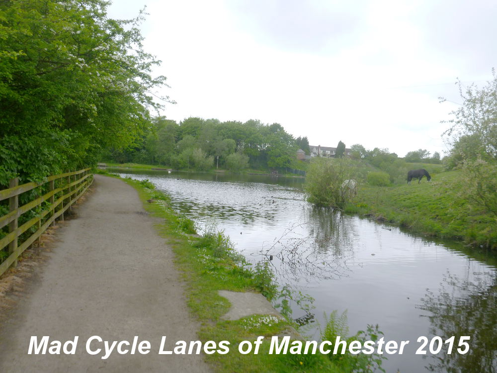
Showing posts with label Oldham. Show all posts

Monday, 31 August 2015

Delph Donkey Line - Delph to Undermill

The Delph Donkey path is on the old trackbed of the London and North Western Railway (LNWR) branch linking Delph with the Huddersfield line, which is still in use today.

Starting out from Delph New Road, just down from the junction with Oldham Road the site of the old station is marked by this sign.


The path goes into a small housing estate on Station Approach.


As Station Approach turns to the left the route of the railway goes onto waste ground.


Here a developer blocked the route back in 2008, but nothing came of it and the fences have been broken down, though the access is over a steep bump.


The path covers the waste ground that was to be the development,


and exits through another broken down fence. Here the steps on the left go down to the road.


Now the path gains a good surface and is reasonably well maintained.


After the first bridge


is the site of Measurements Station marked by another board.


Now the path surface widens and the view opens up to the right,


and then as the land rises to the left there is more to see on the left.


This bridge goes under Wall Hill Road at an angle,


Then after the path curves to the left this short tunnel goes under Streethouse Lane.


Just beyond a house driveway interupts the path on the level with two sets of barriers.


The barriers are set too narrow for many bicycles.


The view now opens out to the left


and this is the most pleasant of the picnic benches, it's the only one with a good view.


Shortly after is the site of Dobcross Station, just before the bridge over Ladcastle Road.


It also has a station board.


The final section of the path ends in another barrier.


The trackbed continues as a footpath for a short way before reaching the railway line.


Here the end of the path is marked by a simple wooden sign.


You can reach the Huddersfield Narrow Canal by going down the road under the old trackbed.


As the road turns right go straight down to reach the canal under the railway viaduct.


Wednesday, 24 June 2015

Hollinwood Branch Canal 3 - Stannybrook Road to Crime Lake

This post picks up where Hollinwood Branch Canal 2 - Droylsden Junction to Stannybrook Road left off, trying to cross a rather nasty road. The character of the path now changes from quiet Site of Special Scientific Interest into the popular Daisy Nook Country Park. There used to be a hump-backed bridge here to carry the road over the canal, but it is long gone.


Once you successfully cross the road and avoid being hit by the 4x4's in the car park you reach a little building which contains a small tea shop - somewhat of a rarity on most traffic free cycle routes in the Greater Manchester area.


The next thing you see at the end of the car park is this narrow boat shaped play area, sadly the nearest you get to a boat on this whole canal.


A little way beyond there is a small patch of water and then the entrance to what used to be called Dark Tunnel, but it was opened up into a cutting following mining subsidence.


The tunnel section is tarmacked over and infilled.


Past the tunnel, there is another short stretch of water before reaching Woodhouses Aqueduct over the River Medlock.


It has quite a spectacular curved shape.


Next you meet the remains of a lock, and then the canal turns sharply to the left.


Here there were a set of staircase locks.


The canal climbed steeply here past a basin to the canal junction.


This is Waterhouses Junction, the start of the Fairbottom Branch Canal. Here you can join the Fairbottom Branch Canal and Tramway - Waterhouses Junction to Park Bridge.


From here the Hollinwood Branch is in water. The path now goes over this outflow. The route through the water is perfectly ridable on an ordinary bike.


The path then goes under this footbridge


and over a small aqueduct


before the canal widens into Crime Lake.


This was apparently created by accident.


At the end of the lake is the site of Crime Bridge. This has now been filled in and marks the end of the usable section of canal, the next section is rather difficult to follow.


You can exit here onto Cutler Hill Road, though the gap is narrow. If you follow the path round the lake to the car park it is probably easier for larger pedal cycles to exit.


Saturday, 20 June 2015

Hollinwood Branch Canal 2 - Droylsden Junction to Stannybrook Road

This post is the continuation from Hollinwood Branch Canal 1 - Sunnyside Road to Droylsden Junction north and east towards Daisy Nook Country Park.

At Droylsden Junction the original aqueduct has been replaced by a narrow bridge with a wooden base. It is quite safe, but a bit unnerving to cross.


The path opens up after the bridge, somewhat overshadowed by buildings on the left.


Soon you reach the former location of a swing bridge that gave access across the canal to Lumb Farm. However, you first have to negotiate a pretty dreadful (anti)cycling kissing gate where tricycles and tandems will have to be up-ended or lifted over.


Lumb Farm is now the location of a large industrial operation called Hadfield Wood Recyclers. Watch out for the HGVs entering the site.


Across the wide entrance road you can get to the next section of canal through the gap on the right of the fence, the gate is locked, and then through a wooden (anti)cycling kissing gate. Again trikes, trailers and tandems will struggle.


Just beyond the gate this sign marks the beginning of the Hollinwood Branch Canal Nature Reserve which includes all of the rest of this section of the canal.


The sign reads...
Owned by Tameside Metropolitan Borough Council and managed by Cheshire Wildlife Trust. The Hollinwood Branch of the Ashton Canal is an excellent example of its type of a standing water system in the Greater Manchester area. This coupled with the number of regionally and nationally rare species found within it, lead to it being notified as a site of special scientific interest. The main habitats are swamp and fen. The open water areas are particularly diverse, containing species such as Water Soldier, Arrowhead and Frogbit, as well as a varied aquatic fauna - Dragonflies, Common Frog and Common Newts. Pike, Rudd and Common Bream are found in open water with Mallard, Moorhen and Reed Bunting. The towpath along the length of the canal makes up part of the Medlock Valley Network and walkers can view this interesting habitat from a convenient position.

This is the point where the path begins to look like a proper canal towpath alongside something resembling a canal. The first part is overshadowed by the barrier of trees on the left, but this is soon left behind. The boundary on the left of the towpath is the dividing line between Oldham and Tameside.


The trees on the left become a hedgerow and the far bank has farmland beyond.


The path itself is however is quite narrow and quite rough, but rideable on a hybrid bike.


Here you enter a hidden gem, an almost secret area, it's one of my favorite paths in the whole of my exploration of Greater Manchester.


As the canal curves gently to the right the canal passes under Cinderland Bridge which carries the path to Cinderland Hall Farm.


It is a tight squeeze to get under the bridge, because as the land subsided the banks of the canal were built up to keep the water in. North of the bridge was a dam and the canal returns to its sunken level.


Now there is some open water in this section of canal. Brookdale Golf Course is on the left of this section. The surface is smoother here, though muddy in places.


However, this soon ends and it becomes clogged with plants again.


The canal swings to the right again, heading almost due east and reaches the site of an old swing bridge, now replaced by a fixed wooden structure. By now the roar of traffic is beginning to assault the ears.


From here the path swings away from the canal and upwards as the traffic gets ever louder.


Soon you hit the bridge over the M60.


This eight lane scar through the landscape is completely out of keeping with the surrounding landscape and severs the canal at this point.


The path drops away on the other side returning to the canal route.


However from here there is no water in the canal.


In places it has been infilled above the level of the towpath, which changes the character of the route considerably.


The path then widens and moves over the canal bed as gates come into view.


This (anti)cycling kissing gate leads out to Stannybrook Road, and the road beyond leads into the car park of Daisy Nook Country Park.


This is a really dangerous crossing, it drops steeply to the left,


and to the right there is another junction, hidden from view to anyone crossing into the park, and there is nothing to protect people crossing the road from the speeding traffic.