Showing posts with label barriers. Show all posts

Wednesday, 4 April 2018

Segregation - by wooden fence?

This small section of cycle track has been closed for months whilst contractors have been digging holes for some reason. Now the workforce has departed a wooden fence has appeared between the cycle track and the pavement.


Strangely a further fence has been built to block the route and force cycles into the road - a dual carriageway with heavy traffic. Notice how the cycle track has not been resurfaced at its original level.


So why on earth are these fences here? Are they a new infrastructure experiment or some idiotic idea hatched up by a rogue council officer or contractors trying to cut corners?


Or could this be a land ownership issue?


Answers on a postcard please...

Monday, 31 August 2015

Speed bumps, locked gates, loose chippings and new dismount signs - Making cycling inconvenient on the Ashton Canal

When I walked along the Ashton Canal back in April the resurfacing was still underway. Progress was promising, with a good quality tarmac surface being laid, though the work did seem to be rather slow. This route is part of the Velocity plans, so the money has come from cycling budgets.


Four months later and the final touches are mostly done.

Final touches designed to make cycling uncomfortable, noisy, dangerous and inconvenient.

Speed bumps

Yes, speed bumps!

So, you put down a decent tarmac surface, then ruin it with these cobbled bumps. There are scores of them all along the path. Total waste of money, money that's supposed to encourage cycling not discourage it.


Locked Gates

Yes, gates which have been open are now locked.

This was last year...


and now. Try getting a bike and child trailer through this - impossible without lifting it over. Remember this is a Velocity route that is supposed to encourage cycling not discourage it.


Loose Chippings

Remember that lovely smooth tarmac surface in the first photo?

Well forget it!

Almost the entire route has been covered in a thick layer of loose chippings. This makes progress along the path slow and noisy, and if that dog runs out in-front of you your brakes will simply lock up so don't bother with the front brake if you want to remain upright.


and then there are the holes, but I'll get to them later...


Cyclists Dismount

Yes, the signs of failure are everywhere, many of them new, presumably paid for with Velocity money. So cycling money is being spent telling people to get off and walk.


There have always been dismount signs on this route, but they are multiplying, thanks to Velocity funding.


The main excuse for them is the narrow path under the bridges.


But no attempt has been made to widen the path or provide alternatives, and in most cases nothing has been done to repair the poor surfaces under the bridges.


Likewise the cobbled surfaces by the locks have not been repaired, despite being in a dreadful condition.


Lighting

Yes, there has been some attempt to put in lighting - solar powered lights in the path, white, except above some locks


where they are red. However, they are unlikely to provide sufficient lighting to persuade most people to cycle along this route in the dark. Many of these lights are shaded by fences & trees so they won't charge up in the winter when they are most needed.

Only a few of these lights have gone in so far at the Manchester end, the rest of the path is covered in holes.


I know from posts on Twitter that many people have gone back to cycling on the road, because the Ashton Canal path is now really inconvenient for daily commuting. Looks like TfGM and the Canal and River Trust have managed to divert cycling money into upgrading a footpath whilst discouraging people from cycling on it.

Monday, 1 June 2015

Hollinwood Branch Canal 1 - Sunnyside Road to Droylsden Junction

The Hollinwood Branch of the Ashton Canal ran from Droylsden to Hollinwood. It was opened in 1797 to transport coal to Manchester from the collieries that lie between Ashton under Lyne and Oldham. For more details see the Pennine Waterways web site. This route is clearly shown on the Tameside cycle map.

The canal branches away at Droylsden Marina. The towpath of the main canal is on the opposite bank. From this point the path along the Ashton Canal going west are Ashton Canal 3 - Clayton to Fairfield and east Ashton Canal 4 - Fairfield to Ashton.

You can just see the towpath on the left of this picture looking from the branch back to the main canal.


Looking towards the new marina, this is a short section of restored canal.


However, the canal ends here. The path of the canal goes under the bridge carrying Manchester Road, next to Droylsden Library. But the route is blocked.


The usable towpath of the canal begins at Sunnyside Road, the site of Clifford swing bridge, opposite St Stephen's View, which has been built on the bed of the canal. Refreshingly there are no anti-cycling barriers to bar your way.


From here the path runs along the infilled canal. The surface is only grit, but good quality if rather narrow.


There is some lighting of the path, and the space is pleasant and wide.


However, after about a quarter of a mile the path reaches playing fields.


Here the barrier is pretty impossible. it is a struggle to get a small bike through here, anything larger is almost impossible without removing the gate... The path is tarmac from this point.


The route of the canal turns to the left here and there is a second barrier as the route runs round Lumb Clough.


Here the land slopes away to the west into Lumb Clough.


This area is quite wooded, and the path is narrowed by the bushes. There is housing on the right behind tall fences.


As the trees clear, the fence along the railway line come into view.


From here the canal towpath continues over the railway line on a narrow footbridge. This can be followed in the next post Hollinwood Branch Canal 2 - Droylsden Junction to Stannybrook Road.


To the west from here one path heads towards Clayton Vale, and another heads east along a disused railway line to Audenshaw.


This was the site of Droylsden Junction and just to the east was the former location of Droylsden Station.


Image from Railmap Online


Sunday, 8 February 2015

Ashton to Oldham Greenway

This route begins about half a mile from Ashton-under-Lyne town centre, just to the north of the site of a short tunnel under Lordsfield Avenue and follows the path of the Oldham, Ashton and Guide Bridge railway most of the way. There are the usual set of barriers to make access difficult for non-standard cycles, but nothing out of the ordinary. I rode this route with Ian Tate who features in many of the photos.


To get to the start of the path go up Turner Lane, past the railway station, fork right to avoid going down Turner Street and the path entrance is at the end of Turner Lane. To get here from the end of the Ashton Canal is a nightmare, and we ended up walking most of the way.


The path has been designated NCN Route 626.


The first notable landmark on the route is the three arched bridge under Cranbourne Road.


The next bridge carries a footpath that connects to Waterloo Road,


which is soon followed by this new structure that takes the path under Wood Lane.


After Wood Lane the character of the path changes. It looks like the cutting has been filled in, and the path goes between two modern housing estates, mostly hidden by the trees.


There is another barrier where the path crosses between Meadowbank and Bristol Avenue.


The path then enters the countryside, where at Alt Hill Lane, the old bridge has been removed. There are the usual barriers


and a notice reminding you that this is not a right of way...


After Alt Lane the path climbs back up to the track bed. Be warned this part of the path is often used by novice horse riders so watch out!


As you approach Park Bridge, just before the location of the old railway station, the path then curves away to the right, taking you off the main trackbed and onto the route of a siding that ran quite steeply down to the ironworks. The main line went over a viaduct at this point, but it was demolished in 1971.

There was a bid to build a replacement bridge at this point as part of Connect2, but it failed to get funding.


Here the path descends and has another set of barriers at Alt Hill Road.

Watch out for the horse shit!

At this point it is quickest to turn right down the road and descend into Park Bridge.


However, you are guided across the road and here the tarmac path gives way to a soft sandy surface.


After looping round 180 degrees you cross this wooden bridge and enter the village past the remains of the ironworks. At this point you can join the Fairbottom Branch Canal and Tramway - Waterhouses Junction to Park Bridge route.


Now you have to climb back up through the village


past the Heritage centre, which was closed


and then turn left up Dingle Terrace.


At the end is the path access through this horrible anti-cycling barrier.


There is then a further steep rough slope to regain the level of the old trackbed.


Initially the path runs somewhat to the east of the old railway line,  but then goes round the edge of this field. This is roughly the location of the local authority boundary between Thameside and Oldham.


and rejoins the trackbed at this right turn.


The path now regains the character of an old railway for a while.


Here there is open land to the east, and Hathershaw to the west


There are the occasional strange markings in the tarmac...


A bit further north there is a lot of new housing and other development going on and it looks like this has been used as an access route.


The path then swings to the right, leaving the track bed where there are football pitches on the right hand side.


Here there is another barrier as the path now turns into Kings Road.


Here Honeywell Lane turns left and becomes Kings Road.


The path now can be seen to the left, where it gets back on to the old railway trackbed.
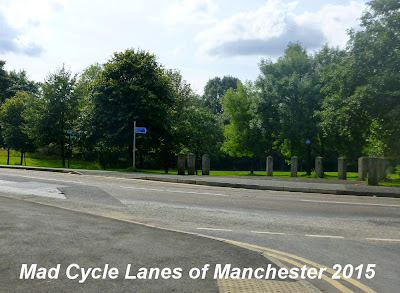


Here the path is part of a linear park that runs alongside the road.


This sign marks the path across to Alexandra Park and the Wheels for All project.


The path then sweeps gently to the right


before ending, somewhat abruptly at Park Road in Oldham.


Here the sign gives no clue as to where the path goes next.


On the opposite side of the road is a huge Matalan outlet.


The car park is roughly the site of the old Clegg Street Station, but there is no sign of it now.


This is more or less the end of the Oldham, Ashton and Guide Bridge railway, and the next section of line will be the subject of a separate post.


Map showing the whole of the Oldham, Ashton and Guide Bridge Junction Railway (in yellow) and connecting lines.