Showing posts with label Cheshire Ring. Show all posts

Tuesday, 14 October 2014

Ashton Canal 4 - Fairfield to Ashton

This two and a half mile stretch of path runs along the Ashton Canal towpath from the junction with the Hollingwood Branch Canal, known as Fairfield Junction to the junction with the Peak Forest Canal, Dunkfield Junction and on to the end of the canal towpath in Ashton, where it turns into the Huddersfield Canal. This is a continuation from Ashton Canal 3 - Clayton to Fairfield.

This section was ridden with Ian Tate, who features in many of these photographs.


The first bridge, under Fairfield Road, is very narrow and has an uneven surface, so take care.


Just beyond is this narrow path, turn right here


and a little way along you will find the Moravian Settlement, a weird time capsule of cobbled streets, founded by a religious sect.


Back on the canal, the path in this section is reasonably well surfaced, here it goes under Manchester Road.


Further along, near Lumb Lane, the canal widens, this section was realigned at this point.


Soon the canal passes under the M60, here we found a boat moored up in the shelter of the long bridge.


After passing under the railway, the canal has moorings on the far bank.


However, this is where the towpath dgrades badly, and the mud is quite bad here, and pretty dreadful after rain.


The morings end at the bridge under Hanover Street North.


Then after passing under the A6140 this disused railway bridge comes into view as the canal turns right.


This rather imposing structure takes the canal under Stockport Road,


and at this point the character of the canal changes, becoming a little less urban.


A little further along Ian disturbed this heron on the towpath. It settled on the far bank long enough for me to photograph it.


This pink, pedestrian bridge is at the end of Potteringer Street, and is the start of the final section of the canal.


This little bridge crosses over the entrance of Princess Dock.


Ian paused for a photo opportunity.


The next bridge goes under Margaret Street, next to the rather spectacular, 210ft high Junction Mills chimney.


After this bridge the path goes over this overspill into the River Tame


and then heads towards Portland Basin.


Here the warehouse was destroyed by fire in 1972, but has been rebuilt to house the Portland Basin Museum and, most importantly for those cycling or walking, the Bridge View Cafe.


A cobbled bridge takes the towpath over the entrance to the Peak Forest Canal.


If you want to get over to the cafe on the far bank


you will have to carry your pedal cycle up this set of steps and down more steps on the other side.


Beyond the foot bridge there are more moorings


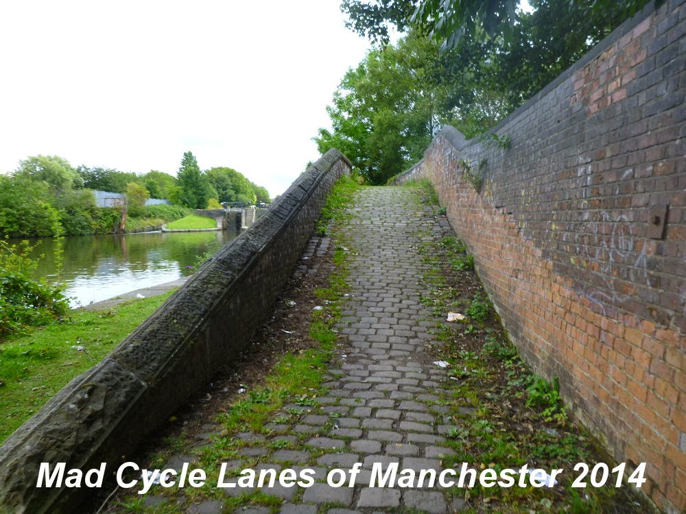
and then the path is blocked, forcing you up this ramp.


This ramp emerges on Cavendish Street, opposite the Asda Supermarket which has been built across the start of the Huddersfield Canal.


This point effectively marks the end of the Ashton canal. From here the road system is pretty dreadful. The centre of Ashton has a dreadful one way system which is simply dreadful for cycling. From here it is possible to cross the town centre to reach the NCN 626 railpath to Oldham, but me and Ian ended up walking most of the way.


View Ashton Canal 4 - Fairfield to Ashton in a larger map

Sunday, 5 October 2014

Ashton Canal 3 - Clayton to Fairfield

This one and a quarter mile stretch of path runs along the Ashton Canal towpath from the junction with the Stockport Branch Canal to the junction with the Hollingwood Branch Canal. This is a continuation from Ashton Canal 2 - Ancoats to Clayton and the Stockport Branch Canal cycle route.


From the signpost with the Stockport Branch Canal cycle route the path goes over the cobbled bridge which goes over the original canal junction.


The path starts of reasonably good, but there are many locks along this section.


Soon, however, the path degrades and is sometimes muddy.


At lock 13 there is the somewhat strangely named Strawberry Duck Pub.


The Yew Tree Swing Bridge


and the Copperus Lane Swing Bridge


and as you reach the last two locks, both of which were double there is what's known as the camel's hump footbridge. You can see from the photo how puddled this part of the path is.


Finally the ornate, but unlocked bike barrier marks the arrival at the junction with the Hollingwood Branch, as the canal turns sharply to the right.


Here water has been put back into the first few hundred yards of the Hollingwood Branch as part of the redevelopment of the area.


Next Ashton Canal 4 - Fairfield to Ashton and an investigation of the cycle routes along the Hollingwood Branch Canal.


View Ashton Canal 3 - Clayton to Fairfield in a larger map

Sunday, 28 September 2014

Ashton Canal 2 - Ancoats to Clayton

Continuing for just over two miles from Ashton Canal 1 - Piccadilly to Ancoats this is the point where the Manchester Cycleway joins the canal as NCN 86.


The access to this point from Old Mill Street is very poor at the moment because of the building works.


Once on the towpath the going gets a lot better. Just ahead and to the left is the former course of the Islington Branch, now a marina.


Past the lifting bridge are the new blocks of flats.


Once under under Carruthers Street, the path becomes rougher.


As you approach the bridge under Beswick Street the MERCi building is on the opposite bank.


The path surface improves beyond and after Cambrian Street, curves to the right


then after the low bridge under New Viaduct Street and the railway the path turns to the left and the football stadium comes into view.


Now there is a further flight of locks. The path up the first one is good,


but the second and third both have steep cobbled surfaces and are best walked on a small-wheeled bike.


At the next bridge the canal passes under the Alan Turing Way.


After the bridge, turn left onto the cycle track. Here NCN 86 carries on into Philip's Park and NCN 60 now joins from the Alan Turing Way. Turn left again off the cycle track and back onto the canal towpath.


The path surface is less smooth now, but still tarmaced.


You can't miss the bridge over to the velodrome.


At this point in the ride I was joined by Ian Tate, who's back now features in many of the following photographs.This point in the path, just after the Velodrome bridge is probably the entrance to the Clayton Arm of the canal.


There are several barriers and Cyclists Dismount signs along this section, but all the gates are now opened, so the barriers can all be bypassed.


Under the next bridge and the path has been recently resurfaced and widened as part of the development of the football academy on the right.


The path alongside the lock 9 has into small steps


and then by lock 10 it is cobbled again.


After lock 10 the junction with the path along the old Stockport Branch is clearly signposted. NCN 60 turns off to the right at this point whilst the Ashton canal continues over the bridge which goes over the canal junction itself.


Next section going east is Ashton Canal 3 Clayton to the Fairfield Junction, going south is the Stockport Branch Canal.


View Ashton Canal 2 in a larger map