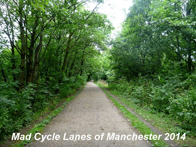
This post covers the section from the site of Monton Green Station through Worsley Station to the junction with Roe Green Loop Line at Roe Green. Part of this route is covered by a Herritage Trail leaflet.
The site of Monton Green Station was several feet above this small roundabout on the B5229. The station has been completely demolished, as has all sign of the line to the south. There is no signage at all on this road pointing out the start of the railpath, which is on the right just after the roundabout despite it being part of NCN Route 55.

This is the entrance, the winding path that begins behind the red barrier. There is no drop kerb or any other concession to pedal cycles. The entrance to the left of the picture leads to a brand new car park, so drivers have been well looked after...

The path leads up a short slope into the trees and straight into the one and only barrier on this section of path.

It is a horrible U-bend barrier with a bike A-frame bypass. Enough to defeat some pedal cycles, but not as bad as many in Salford.

Once you are through the barrier the path is well surfaces with a reddish tarmac. It runs along a wide embankment with trees on both sides.

Unfortunately there has been little management of the trees and you get just a few glimpses of the open views on both sides.

To the left at this point is Broadoak Park the subject of a battle to prevent it being built on and to the right is Worsley Golf Course.

About 3/4 of a mile up the path it crosses a stream

and brings you to the site of Worsley Station. Unlike most other former stations in the area, this one still has some reminder of it's existence.

Just to the north the path passes under the A572 Worsley Road, through a rebuilt bridge, much smaller than the original.

The bridge is a corrugated iron tube with ivy falling over both entrances.

This is where the surface changes from tarmac to rough stone and gravel. This section is currently the subject of a consultation by Urban Vision on behalf of Salford Council.
According to an email from Urban Vision:
Phase 6 and 7 improvements, of approximately 2.4km, will begin at Worsley Station (the original railway station) in Worsley, passing under the motorway bridge towards Roe Green and under the East Lancashire Road to Mesne Lea Primary School. This 600k project will link the existing improvements from Tynesbank through to Monton Green and will include re-surfacing works, the installation of drainage, the construction of access paths and steps, as well as the installation of benches along the route. Urban Vision has completed design of the scheme, and it is now proposed to go out to tender on 25th July 2014, with a view to the works starting at the end of October for a 14 week period. It is anticipated the works will be completed by early February 2015.
My main concern is that the path is likely to be closed for 3 months and that they do not install any new barriers or other obstructions on the route

The path isn't too bad at this point where the footpaths cross

but it gets pretty muddy soon after

and as you reach the rather daunting bridge under the M60 it degrades further.
These long bridges should have lighting installed.

Just to the north of the motorway is one particularly large area of mud that can only just be avoided.

A short way further on the trees on the left disappear, along with the embankment.

This is the site of a new United Utilities facility built to prevent sewerage getting into Kempnough Brook. It consists of an underground bifurcation chamber fitted with a powered screen, a 1,545m3 detention tank, a weir and a powered screen chamber.
This was the work that closed this route last summer.

From here the surface of the path is rough, but fairly dry all the way to the junction at Roe Green, where the two bridges carry Greenleach Lane over the continuation of the Tyldesley Loopline to the left as it turns west and the newer Roe Green Loop Line to the right which continues north heading for Bolton.

To be continued in separate posts.
Tyldesley Loop Line 2
Roe Green Loopline 1
View Tyldesley Loopline 1 - Monton to Roe Green in a larger map
I've just been down this today and am happy to report that it is now open.
ReplyDeleteNo new barriers that I could see and indeed, the one at the end of the corrugated iron tunnel has been removed. The big steel fence that was there has been knocked over and is currently lying flat across the trail (it's passable) and lots of orange fencing by the side of the trail is still there.
The surface has been tarmacked and is sooooooooooo smoooooooth :D
Officially open now.
ReplyDeleteYes very smooth - just got out there this afternoon, freewheel most of the way back.
3.5 years later - how is this trail now? Is it usable all-year-round or is it more of a muddy swamp in the winter ?!
ReplyDeleteUsed this a few weeks ago - absolutely brilliant. I used to think the Fallowfield Loop was ace... this line is even better. Brilliant.
ReplyDelete