Showing posts with label Tea Stop. Show all posts

Wednesday, 24 June 2015

Hollinwood Branch Canal 3 - Stannybrook Road to Crime Lake

This post picks up where Hollinwood Branch Canal 2 - Droylsden Junction to Stannybrook Road left off, trying to cross a rather nasty road. The character of the path now changes from quiet Site of Special Scientific Interest into the popular Daisy Nook Country Park. There used to be a hump-backed bridge here to carry the road over the canal, but it is long gone.


Once you successfully cross the road and avoid being hit by the 4x4's in the car park you reach a little building which contains a small tea shop - somewhat of a rarity on most traffic free cycle routes in the Greater Manchester area.


The next thing you see at the end of the car park is this narrow boat shaped play area, sadly the nearest you get to a boat on this whole canal.


A little way beyond there is a small patch of water and then the entrance to what used to be called Dark Tunnel, but it was opened up into a cutting following mining subsidence.


The tunnel section is tarmacked over and infilled.


Past the tunnel, there is another short stretch of water before reaching Woodhouses Aqueduct over the River Medlock.


It has quite a spectacular curved shape.


Next you meet the remains of a lock, and then the canal turns sharply to the left.


Here there were a set of staircase locks.


The canal climbed steeply here past a basin to the canal junction.


This is Waterhouses Junction, the start of the Fairbottom Branch Canal. Here you can join the Fairbottom Branch Canal and Tramway - Waterhouses Junction to Park Bridge.


From here the Hollinwood Branch is in water. The path now goes over this outflow. The route through the water is perfectly ridable on an ordinary bike.


The path then goes under this footbridge


and over a small aqueduct


before the canal widens into Crime Lake.
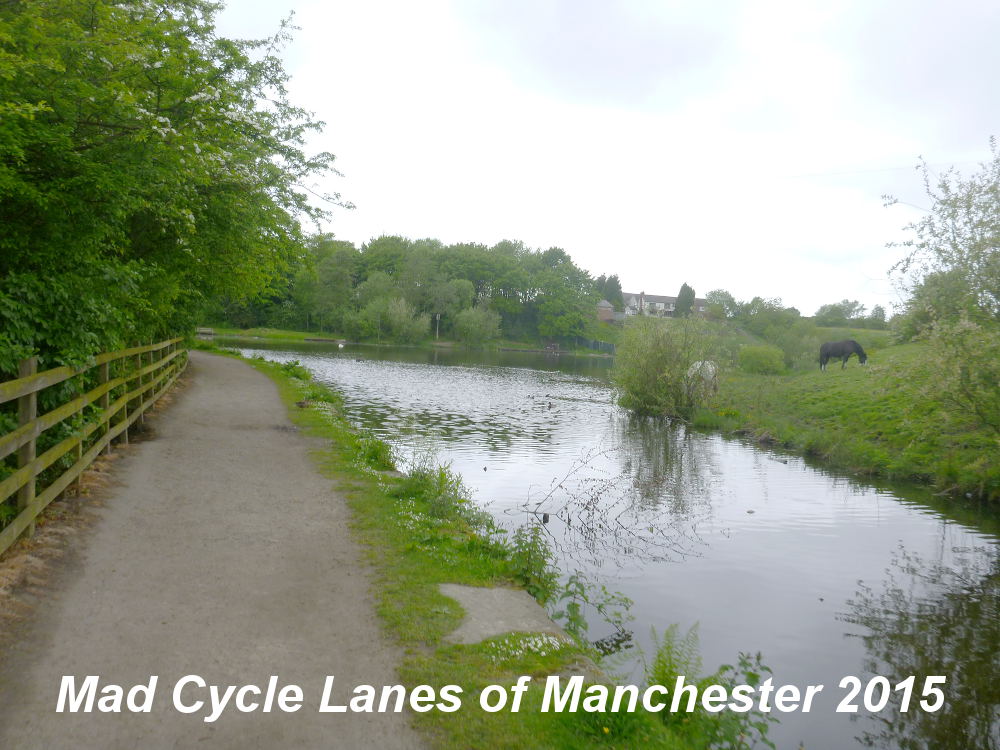


This was apparently created by accident.


At the end of the lake is the site of Crime Bridge. This has now been filled in and marks the end of the usable section of canal, the next section is rather difficult to follow.


You can exit here onto Cutler Hill Road, though the gap is narrow. If you follow the path round the lake to the car park it is probably easier for larger pedal cycles to exit.


Monday, 8 September 2014

Peak Forest Canal - Ashton to Hyde

This path from Ashton to Hyde along the towpath of the Peak Forest Canal is not marked on the TfGM cycling map for Tameside, but it does appear on the Ordinance Survey Explorer map, marked as a traffic-free cycle route and labelled as the Tame Valley Way. This two and a third mile long section is well surfaced, entirely level and free from cycle barriers along its length. It is a very pleasant bike ride, but slightly spoilt by the smell from the many sewage works along the route. Unfortunately south of Hyde the path degrades considerably.

The Canal starts at Portland Basin, opposite the Industrial Museum which also has a cafe, providing a useful tea stop if you have cycled here some distance. Access from Ashton-under-Lyne town centre is via the Ashton Canal tow path, which slopes gradually down from Cavendish Street, opposite the Asda supermarket, and has no access barriers. However, from this direction you will need to get over the steep cobbled bridge to get to the tow path.

You can't miss the start.


To the left of the sign, go under the towpath bridge and round to the right


and immediately over the River Tame on a stone aqueduct. On the left is the Portland Basin Marina which is on the Alma Street Branch.


The canal then passes under the ornate railway bridge, the former site of Duckinfield Central station.


Beyond the railway, the view of the River Tame opens up briefly


and the path takes on a pleasant rural character.


The path is surfaced with a light-coloured tarmac finish that blends in well with the surroundings, whilst marking it out clearly.


There were a few boats and the occasional angler when I rode the route.


The next bridge is a lift bridge which is the access to Plantation Farm.


Beyond the canal gently curves to the left


and then passes under another railway bridge. This one has rather limited headroom.


The next road bridge is the only serious obstacle for larger cycles


because the path under the bridge is quite narrow and uneven.


To the right side of the canal you get the occasional view of the sewage works and other industrial plants, showing the rural character is a well crafted illusion.


This bridge provides access to Globe Lane.


On the opposite bank you pass Warble Boatyard.


The next bridge gives access across the canal to Newton Hall, a reconstructed 14th century house and on the right is Jet Amber Fields.


There is a final section of a rural character


before the canal hits the M67 motorway where it was realigned.


Beyond the motorway lies Hyde Wharf.


Here the high quality surface suddenly ends to be replaced by a narrow grit track.


Passing under the Manchester Road Bridge the towpath is sent up and over the canal, though there is now a stretch of bridal way on the other side.


From here the towpath is narrow and unsurfaced


and soon degrades into stretches of deep mud, so it is best to leave the path at Manchester Road, unless the weather has been very dry, or you don't mind getting very muddy...


View Peak Forest Canal 1 in a larger map