Showing posts with label closure. Show all posts

Saturday, 6 June 2020

Oxford Road Cycle Track Closure

A whole section of the Oxford Road cycle track, southbound from Charles Street to Brancaster Road has been closed overnight.


It seems that the building work on the old BBC site has been given permission to take over the whole of the pavement and the cycle track.


So the only safe way to cycle along here is to take the centre of the lane to prevent unsafe overtaking.


My bet is they will now simply use the extra space to park vans & cars...


So much for, so called, popup cycle lanes and new infrastructure.

Saturday, 9 January 2016

Irwell Towpath Closed in Ordsall

The floods over the holidays has done considerable damage to the Irwell Towpath in Ordsall. Opposite Pomona tram stop, next to Soapworks the path has been undermined, and much of this section was washed away. Further along the path also seems to be falling towards the river. The gate underneath the tram bridge has been locked shut, so this section is completely unusable and is unlikely to be repaired for many months, and possibly years.


This is in addition to the considerable amount of sand and silt that has been washed onto the lower parts of the path upstream.


So this leaves the many commuters who use this path looking for traffic free alternatives between Salford Quays and Manchester City Centre. You can cycle along Orsall Road, but I wouldn't recommend it.

There are two alternative traffic free routes, though both are unlit, so you need a good set of lights to negociate them at night. The route across Pomona is somewhat disconcerting in the dark, especially with the off-road motorbikes being ridden around, whilst the Bridgewater Canal Towpath is busier, making it feel safer, but you have to concentrate on the path surface to avoid ending up in the canal.

The nearest alternative is across Pomona. Go over the Green Bridge from Woden Street and then go through the gap in the fence on your right before the viaduct and along the muddy path. After a sharp drop the path turns into a wide gravel track.


Here you will be greeted by birdsong and the noise of the trams. Though the birds were quiet on Friday morning because of the presence of a kestrel hovering above the verge.


The track turns to tarmac in places, but watch out for some very deep potholes.


From the bridge over the lock between the Bridgewater Canal and the Irwell the route is then downhill to Pomona Tram Stop.


You then have to get onto the pavement to get through the gate.


From here you get a view of the damage to the towpath and see how it was undermined in the floods.


Then follow the road up to the roundabout by Throstle Nest bridge.


The other alternative route is through Castlefield Basin and along the Bridgewater Canal Towpath. This route has reopened as the remains of the collapsed building have now been removed from the path and the building has finally been demolished.

This is supposed to be an official Velocity Cycle route, but it is pretty poor. The cobbles are quite large and no attempt has been made to fill in the gaps, and on a small wheeled bike you could easilly catch your wheel in one of the gaps and find yourself being thrown into the canal.


There are also several steep bridges over the wharves, which will mean many people will have to get off & push.


The final bridge has a particularly poor surface.


Further along there is a very narrow bridge under a road, though thankfully there is now a handrail which makes it less scary.


And the open sections are covered in thick loose chippings, making it difficult to keep control of the bike, especially when passing cycles coming the other way as you end up on the thicker layers of gravel.


This route again brings you out at Throstle Nest Bridge.

From here there is another section of damage on the Trafford side of the towpath, though it hasn't been closed off yet.


Neither route is ideal, but both offer the chance to avoid the unpleasant experience of cycling on the roads and suffering the threats and abuse from passing motorists...


Monday, 18 May 2015

Destruction of a cycle track

In many cities in the UK they are building new cycle tracks, but in Manchester they are being destroyed. These signs have recently been erected to tell us that our cycle route has been closed.


However, there is no alternative route signposted, nothing at all.


It is a case of tough shit, no more cycle track, no more bus stop bypass, you now have to cycle through the bus stop!


The cycle route sign still exists, behind bars.


The other side of the fence you can see that the cycle track has already been destroyed.


Almost all of it has been removed.


So, how on earth has Manchester City Council allowed this to happen? I don't know, but if anyone can find the planning documents for the Water Street Project, we may be able to find out.


Sunday, 5 April 2015

Dantzic Street Closure

This recently created cycle cut-through has been closed off.


It looks like there are going to be several buildings demolished round here.


It is clear that the contractors don't care much for the cycle route!


This is what it used to look like...


Sunday, 1 February 2015

Ashton Canal Towpath Closures

According to the TfGM web site there will be temporary closures along the Ashton Canal Towpath.
Ashton Canal Cycleway – From late January, sections of the towpath will be closed whilst resurfacing works takes place. Construction of the new towpath will be over a 14 week period, with various sections being closed at different times during the works. To plan alternative routes whilst works take place visit our journey planning pages

Unfortunately that is all the detail being given, as the link just takes you to the maps pages.

They do have a map with a little bit of information about the works, but with no useful details.


So the next place to look for this sort of information is the Canal & River Trust web site.
Here a search for any works on the Ashton Canal returns with

No results found

Which isn't very informative either.

So the towpath may be closed at some point for resurfacing work. However it isn't yet clear whether they will be removing the barriers


and the Cyclists Dismount signs


or getting rid of the dangerous cobbled sections.


Time will tell...

Saturday, 13 December 2014

Trafford Park Tram Plans - cycle routes will be closed for months

After some fuss trying to get the plans for the Trafford Park Metrolink out of TfGM I was sent an email containing a link to a complete set of plans online.

Why on earth TfGM didn't put a link on the notices I don't know, but there has been no publicity about these plans that I have seen beyond the paper notices.

There is good news and dreadful news on these plans.

The good news is the track alignment may have improved for cycling as most routes look like they will cross the track at right angles in more places.

The dreadful news is that most of the cycle routes will be closed for many months during construction work. For example, not only are the access paths being closed, this whole section of the towpath will be shut for the construction work.

The tram lines will smash their way through Sam Platts pub, and demolish the Wharfside Business Centre and the factory adjacent to Quay West. This is different from the original alignment in the consultation which would have run along the road.


Will update as I work my way through the details...

Saturday, 6 December 2014

MediaCity cycle route closure notice

No sooner have TfGM closed the consultation on the Trafford Park tram line than they have made moves to close the surrounding cycle routes. The building of this line will have a major impact on people commuting to MediaCity from South Manchester and Trafford in the same way that Cross Street has become a no-go route for cycling in the city centre.

This notice appeared a couple of weeks ago along the Trafford side of the Ship Canal. It is a notice of an order to close this path, which is a busy cycle route.


The order contains no plans or anything like that but just says it is giving notice of an order to close the path linking Trafford Wharf Road to the path flanking the southern bank of the Manchester Ship Canal.


To request a copy of the plans you have to email Phil.Goodfield@tfgm.com and ask for a copy of the plans. Objections have to be in by 23rd December, so we don't have long.

If this is your route too and from work please request a copy of the plans.

You are going to find your route to work closed, possibly for many months if not more than a year.


This is the view from the other side.


This route is part of NCN route 55 so I hope Sustrans will be objecting too.


Wednesday, 19 March 2014

Irwell Towpath - Work In Progress

I got a closer look at the new lighting going in along the Irwell Towpath last night.


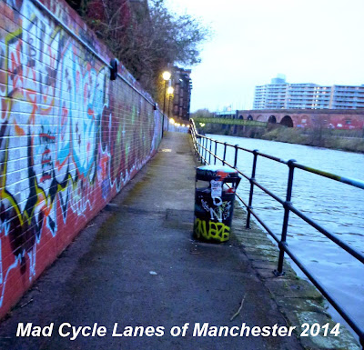
In the wider sections they seem to have rewired the lighting and removed the cobbles,


and the graffiti artists have been having a bit of fun.


Whilst in the narrower sections the lamp posts have been removed


and the lighting is in the process of being mounted on the wall.


This makes the path a bit wider, except where they have left the bin.


Beyond the end of the lighting works is a large patch of new tarmac which has been laid very unevenly and if it doesn't get fixed it will not last long.


All in all it looks like a worthwhile improvement, and it will be nice when it is finished.

Saturday, 15 February 2014

Irwell River Path Planned Closure

FURTHER UPDATE 1st March

It looks they are replacing the useless lighting along the tow path.

Several of the lampposts have been removed and others look like they are in the process of removal as you can see here.


It's a pity Salford Council don't include the reason for the closure in their notices...


UPDATE

The path has now been closed off


The diversion is out onto the rather busy and unpleasant Ordsall Lane


The other end...


No sign yet of what they are doing

----------------------------------------------
Was going to post this a while back, but it's been on hold with all the other recent goings-on and unofficial river path closures.

A solitary notice appeared on one of the lamp posts by the green bridge. It is quite hard to spot and has been pasted around 3 sides of the hexagonal post making it rather difficult to read. It has not been made available on the Salford Council web site as the highway orders page hasn't been updated for over 6 months now.

The notice closes the highway River Irwell Towpath between Fairbrother Street and Woden Street for a length of 450 metres from the 10th of February and continue for a period of 3 months....

As of yesterday 14th February the path was still open, but be warned it may be closed off soon.

Last time this section was closed off two years ago there was only gardening works taking place.


Woden Street end, the green bridge.


The Fairbrother Street end.


View Path Closure in a larger map