Whilst this 12 mile route enables an almost entirely traffic-free ride all the way from Manchester to Rochdale, the surface is very rough in places and there are several sets of steps. The narrow parts of the path will prevent trikes, handcycles and trailers from getting through.
The surface is so bad in places this route is not suitable for small wheeled bikes like Bromptons, as proved, rather painfully by a fellow blogger earlier in the year. This route is suitable for robust tourers or hybrids and mountain bikes, or be prepared to walk quite a bit.
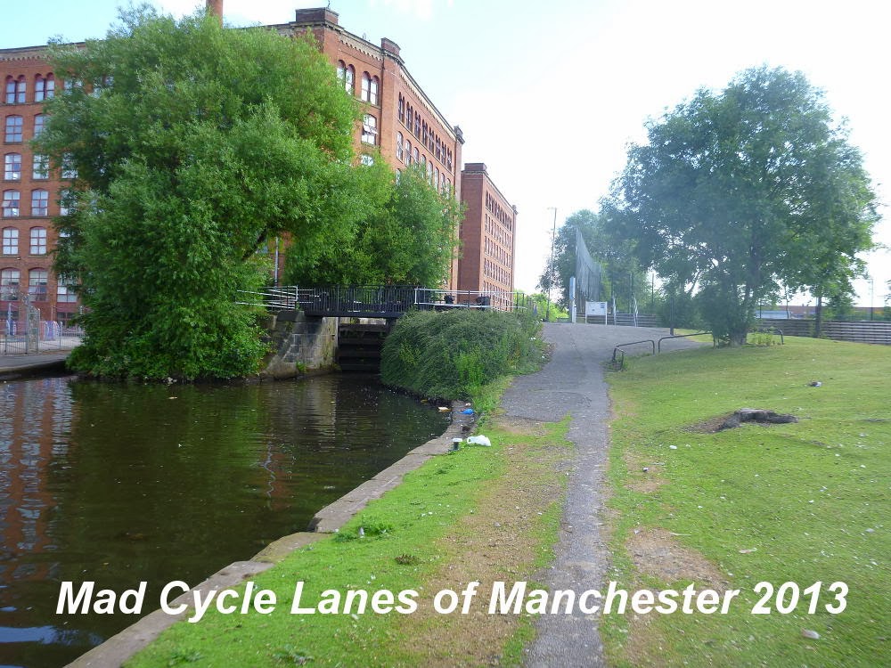
As far as I am concerned, the route starts here, at this lovely bridge just off Great Ancoats Street, the site of one of the city's most awful cycle routes. You can ride past on either side, but the tow path is on the right.

Further on the new bridge may be open now and that leads into this narrow section.

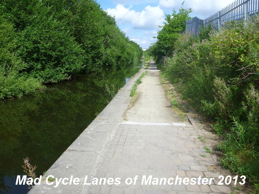
After a narrow section of tow path, unsuitable for anything wider than a bicycle, the path opens out and here we join the official cycle route - NCN Route 66.

This is an open grassy part of Ancoats, where the old industrial buildings have mostly gone. However they did leave one old, narrow road bridge which is decorated by a CYCLISTS DISMOUNT sign. This part of the path does flood in winter, so be prepared for wet feet.

A little further along is Victoria Mill, which stands almost entirely alone in the landscape.
From here most of the path has recently been tarmaced, however, they did leave the original cobbles, where they still existed. They are quite large and uncomfortable, even on my fat wheeled tourer.

This section is more enclosed, but new lighting has been installed.

At Queen's Road (NCN Route 60) you hit the first set of steps, just after the bridge.

It is possible to bypass them by going up to road level, and crossing at the lights, but rather slow and inconvenient.

As you head towards Newton Heath there are more trees, and several of the locks here show signs of having been completely rebuilt.

At Newton Heath itself, the landscapes opens up on the right, but the canal & path are in quite poor condition here.

At Old Church Street there is yet another set of steps.

This time the diversion is more difficult, involving going back and over the footbridge. There are the inevitable anti-cycling barriers to make this difficult. You then go back across the canal on the road bridge and first left.

After going under Poplar Street, you see this distinctive chimney.

A bit further along at Ridgefield street are another set of steps. Whilst there are only a few of them, the diversion to avoid them involves a long road diversion.
Warning - coming in the other direction these steps are difficult to spot!

Soon the buildings become very modern and you pass a number of huge retail outlets,

before the canal turns north, with Failsworth Library on your left.

Here the path degrades rapidly. The bridge under Oldham Road is very narrow and uneven, and the cobbles continue from here.

At George Street, there is this semi-stepped and cobbled slope,

and on the other side the cobbles are particularly large and uneven.

The next bridge takes the tram over the canal and there is this bizarre cycle barrier. An example of some idiot, probably from TfGM, wasting public money.

From here the path has a fairly reasonable surface. However, this overflow is not much further along.

This little footbridge at Henshaw Lane marks a distinct change in the scenery

Soon the path branches right and upwards to meet the road,

then left and up further to cross the M60 on this strangely compelling bridge.

After rejoining the canal the path degrades again. This time the cobbles are quite small and flat,
but they are not always present and the path suffers from subsidence in places. This is a largely industrial area with electricity pylons overhead and factories around.

At the join between Grimshaw Lane and Foxdenton Lane is a little swing bridge.

The industrial landscape gives way to trees and housing,

and the canal swings east then north again after Middleton Road

and crosses the River Irk Aqueduct.

Now the area becomes rural, and these poems suddenly crop up.

The canal then goes under the railway. The railway itself is on the second of two bridges, the one in front is unused.

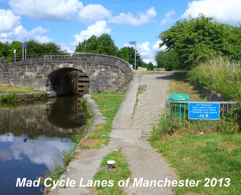
A little further along the path crosses Boarshaw Lane, where there is a single, very large step. The sign points to Middleton Town Centre.
After Middleton, with it's industrial estate on the right the canal goes under Rochdale Road and past this little bridge

you come to Slattocks Top Lock cottages.

Here the canal rises above the landscape, and views open out to the right.

There is one Sustrans sculpture along here.

At the crossing with the M62 the motorway builders failed to provide a towpath.

This usually means a diversion via the A664 Manchester Road

and back via these anti-cycling barriers.

What is supposed to happen is that you can use this pontoon bridge to get under the motorway. However, the day I came past it had been removed and parked here.

A little further along the path swaps sides over a little cobbled bridge.

The path joins Maltings Lane for a bit in this post-industrial area.

At Gorrels Way the towpath runs out again, and you cross the road here and join the pavement on the other side.

then round to the left along Queensway and Edinburgh Way, and across at lights to rejoin the canal. The loss of the path here was caused by the building of the A627M.

Back on the path the landscape improves.

This little bridge over an overflow comes just before

Milkstone Road which marks the point where you turn into Rochdale with a set of anti-cycling barriers. The towpath crosses the canal at this point on the road bridge.

Here you turn left and join the road towards Rochdale. The route is quite mixed, particularly with all the new work to put the tramlines in. The signposted diversion to avoid the tramlines sent me down a very steep and dangerous cobbled road to get to the town centre, so be prepared for problems.

View Rochdale CanalUntitled in a larger map
Thanks for these photos. I'm planning to use this stretch next week as part of a long tour north. Looks like some new tyres to suit the conditions will be needed.
ReplyDeleteThanks for this whole blog. Great photos and practical comments. Just the job.
ReplyDelete